
Hillcock Pt with grey clouds
What’s all that grey stuff? Clouds?! Since when?
That was not what we asked for, but the day was still young and as we left Orpheus and the Palm Island Group to our stern the cloud mass began to lift and tatter. Hinchenbrook Island is huge and bold. It’s mountainous with steep slopes and curving saddles. Craggy granite boulders lay exposed on ridge lines while rainforest nestled in gullies and mangroves gave way to sandy stretches of beach.

Look closely and there is a dinghy at the base of Hillock Pt.
That spectacular line of peaks were muffled under a lurking cloud. But their strong profile remained hanging over a palm tree fringed beach stretching from South Zoe Creek to North Zoe Creek. We were the only yacht to take advantage of those calmer conditions.

Approaching Zoe Bay from the south
Low tide was progressing and armies of small, blue soldier crabs scrambled before our giant shadows. As we headed towards the southern end of the beach, hikers came to greet us. Tales of hardship helping a walker over those big rocks that are Boulder Beach and tales of white-tailed rats fossicking around the metal food boxes in the middle of the night. Anyone who has done the Thornsbourne Track could emphasise.
Eventually, we took our leave. From the Zoe Bay camping area, the trail ran parallel with South Zoe Creek .
First leading through magnificent rainforest featuring the orange brown trunks of Alligator Bark and buttressed blue Quandong Trees. The bright blue fruits of the quandong often littered the forest floor as well as yellow Kapok Tree flowers. Drier Eucalyptus and fresh fronds with a newly sprouting spears on Grass-trees followed. Last year, Burney wrote that ” a recent back burn had turned much of the walk into a hot, black and desolate endurance hike”. Although past charring was evident, bright green regrowth fought its way skyward. The canopy was yet to close over the lane of saplings.

This years regrowth
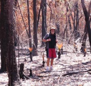
Image from last year
After crossing the creek about 100 m downstream from Zoe Falls, we were rewarded with the rockpool to ourselves. Except, of course for a myriad of Jungle Perch.

Jungle Perch

Zoe Falls
Cool, refreshing, rejuvenating. Free floating while gazing up at the shining black face of the falls’ wall, stark against the now clear blue sky, we decided to continue up the steep slope.
Little more than a goat track, stepping ever higher till we reached the helpful rope ascent over a couple of larger smooth boulders. Then onto the granite slabs above the falls where there were spectacular views of Zoe Bay and like a dot, our boat.

The only level section

A rope to help ascend this last section.
What a reward for a little effort!! Our last walk for a few days.

The granite slabs above the falls with a huge view to the bay
Rising with the dawn, we drank coffee while underway and bid farewell to Zoe as the moon set. We were heading back south to enter Hinchenbrook Channel via Lucinda. With some blustery Northerlies predicted we intended to while away a few days meandering the scenic and calmer waterways of the western side of the island.

Our dawn view of the moon setting

Sunset behind Mt Bowen and Zoe Bay
From the sugar sheds on the wharf to the bulk sugar tower, a conveyor belt jetty projected 3 nautical miles into the sea. An obvious landmark for navigation. However, sailors need to be mindful when cruising the channel from the south, the lateral markers are opposite to your intuition. When once molasses was shipped by tanker, due to the shoaling bars to the east of Lucinda, all commercial vessels navigated from the northern or Cardwell entrance. Hence, as we entered from the south we needed to hold the red buoys starboard not to port.

Sugar sheds at the end of the very long jetty

Lucinda bulk sugar conveyor wharf and jetty

Bluff Creek anchorage in Hinchinbrook Channel
Haycock I. anchorage
Mt Straloch was shrouded in cloud as we passed the fringing mangrove of the Bluff Creek anchorage. We, however, carried on to the Haycock Island anchorage 8nm further northwest. The island was a single steep peak with multi stories of vegetation reaching from the rocks and mangroves of the water level to the peak. Many birds called and Burney saw her first Pied Imperial Pigeon for the season ( migratory bird ).

Haycock Island with Leafe Peak(s) reflected
While the morning was hot and humid, Hans took advantage of the calm conditions to finally rename Brahminy Too. As the northerlies set in we welcomed the breeze but the fetch sweeping down the channel delivered an unbalancing chop. Time to move into one of the side creeks.

Decals done

Hans starts work

Angel Wings? Navigation mark or evidence from a large birds?
Gayundah Creek
We had anchored here last year in the company of four other boats and waited out a wet week with them. Rereading the Hinchenbrook blog from last year brought back memories of a crocodile encounter and lovely birds seen. This time while clouds licked around Mt. Bowen, the skies were mostly blue.

Gayundah Creek mts include the western side of Mt Bowen with the Thumb obscured
The hills fell away in deep loops and folds, runs of green-black in the shadows rose up russet, lime, jade, olive green, greener than green in the sunlight. The western walls of Hinchenbrook were lush. Lustily lush. Canopy vines grew over leafed tree-tops and mistletoe shed long whipping tendrils of vegetation on branches. In the foreground mangroves fringe the creek edges and tributaries preventing dinghy access. With the low tide, wide banks of mud invited birds. Kingfishes and Egrets prowled the banks. And a solitary Great-billed Heron stalked into view. Warily it turned its massive beak and eyed our boat than with slow deliberate strides disappeared into the gloom. Gone.
The winds were strong enough to keep the mozzies and sandflies at bay, but, when the sun went down and the wind dropped, Watch Out! Quickly insect netting was placed over hatches and the smoky mosquito quills lit. Nevertheless, Burney came up in large welts from midges you could barely see. Thank goodness for antihistamines.

Leaving we see Mt Bowen with the Thumb now in view

Great-billed Heron with a Great Egret in the background
Scraggy Point
Thursday Sept 3rd had very light northerlies and since there was hardly a breathe of breeze in Gayundah Ck, we left the insects to themselves. Motoring in the channel only a couple of vessels passed.
We had visited here last year and knew not to dinghy too close to the aboriginal fish traps. No broken sheer pin, this time. It was high tide, anyway. From the beach a short path led to a tree-shaded camping ground with bbq and pit toilet. For us it was the walk along a rainforest track and then a dip in the freshwater creek which was to be very much appreciated. After a few days of not being able to stretch your legs due to mangroves and mud (and maybe crocodiles), we took our time. Being spring, the birds were prolific and Burney strained to recall the birdsong of the more northern species. Varied Honeyeaters and bright red female Shining Flycatchers flashed into view. A cheeky Pale-yellow Robin clung to a tree trunk guarding the track. But more, much more, remain hidden in the canopy calling.

The Haven, Scraggy Pt

The trail was a 1 km circuit that crosses the freshwater creek. A small dam of rocks allows one to lay in a shallow pool with tiny fish trying to nibble your toes. A lovely spot to refresh and birdwatch. We also took a bucket of water to
wash some salty clothes.

Track continues on to return to the creek further along

View while we lay in the stream

Shining Flycatcher- female

Photo from google images


